You are listening to NEWS Plus Special English. I'm Liu Yan in Beijing.
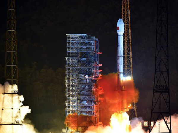
With the recent launch of two navigation satellites, China made another solid step toward building its own positioning system with global coverage.
Scientists put two satellites into orbit for the Beidou Navigation Satellite System, a domestic alternative to the United States-operated GPS, the Global Positioning System.
Chief engineer of the Beidou project Xie Jun says the two satellites are designed to be trailblazers as the Beidou system expands its coverage globally.
Named after the Chinese term for the Big Dipper constellation, the Beidou project was launched in 1994, some 20 years after the inception of the GPS. The first Beidou satellite was launched in 2000.
By 2012, a regional network had taken shape, and the Beidou system was providing positioning, navigation, timing and short-messaging services in China and several other Asian countries.
Beidou is now one of the four dominant navigation systems worldwide, along with GPS, Russia's Glonass and the European Union's Galileo.

This is NEWS Plus Special English.
The impact of El Nino on China is expected to last until the end of this year, and the country could experience stronger typhoons and a longer typhoon season as a result.
Ding Yihui, an academic with the Chinese Academy of Engineering and a climate change adviser at the China Meteorological Administration, said El Nino will have a major effect on China, and its impact will last until the end of the year or even into spring.

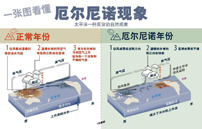
El Nino, a warming of sea-surface temperatures in the Pacific basin, can cause strong rainfall in the south and drought-like conditions in the north.
However, this year's El Nino will not match the intensity of the 1998 weather pattern. El Nino was blamed for massive flooding along the Yangtze River, as well as the Songhuajiang and Nenjiang rivers. The disaster claimed thousands of lives.


